Index
The Shapes Of Seas and Salt Lines
10 March 2026
Peter Coffee
The embroidered patch on my red wool jacket says “14,495 Club,” because in 2006 it was common to use that number as the height of Mount Whitney. As of today, though, that number is considered to be 14,505 feet, but that’s not because the mountain is growing; rather, our definition of the “geoid” (the reference shape of the planet, the surface that would be formed by a 100%-coverage ocean at rest under only the influence of gravity) has changed. For purposes of anticipating effects of climate change, this is more than a cartographic concern.
When we update that shape of “sea level,” that doesn’t only require refreshing of the souvenirs on sale in Lone Pine (the population-2,000 “gateway” to Whitney). It also alters the answers to questions of where and when the rising of Earth’s oceans will require relocations of massive populations. Measuring the starting point correctly, as it turns out, seems to be mostly not being done: “more than 99% of the evaluated impact assessments handled sea-level and land elevation data inadequately, thereby misjudging sea level relative to coastal elevation,” warns a March 4th paper in the journal Nature. “Our meta-analyses on global scale show that measured coastal sea level is higher than assumed in most hazard assessments,” the authors report, and “measured values suggest that with a hypothetical 1 m of relative sea-level rise, 31–37% more land and 48–68% more people (increasing estimates to 77–132 million) would fall below sea level.”
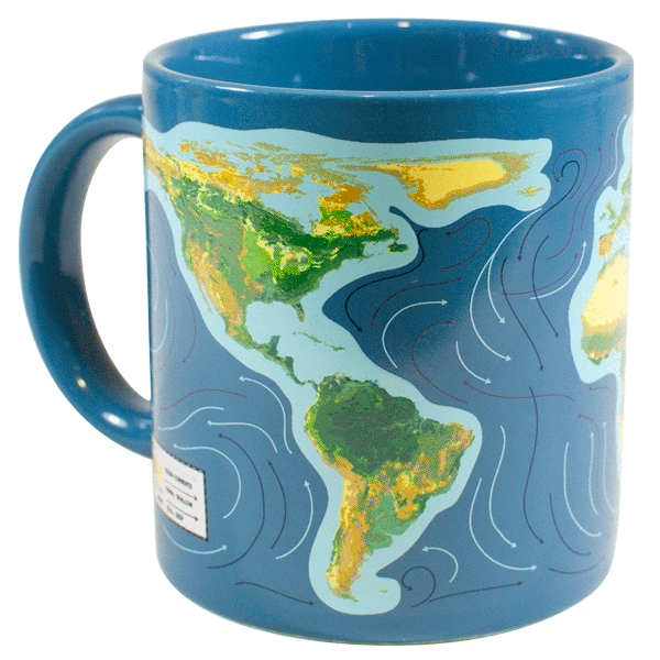
If you’re visually oriented, then perhaps the Climate Change Mug from the Unemployed Philosophers Guild will be a useful aid to grasping what this means. If you wait a moment for the GIF animation to run, you’ll see the coastline-changing implications for the western hemisphere: “before your very eyes, coastlines shrink and ocean levels rise, Florida dissolves and Central America all but vanishes,” the vendor’s description chirps, adding that “if you're the type of person who confronts difficult issues even during your downtime, you should consider getting one…it won’t fix the problem, but it will illustrate it in a really cool way.” Thanks, folks.
Additionally, the alteration of coastlines is just the obvious effect. The Internal Displacement Monitoring Centre, part of the Norwegian Refugee Council, has published some compelling work on “slow-onset events” [PDF] that include contamination of formerly fresh groundwater by encroaching oceans: “As areas of a country become uninhabitable and traditional livelihoods increasingly unviable, new and systemic challenges arise for communities and their governments.”
Further, as previously noted here in December, sometimes things happen “gradually and then suddenly”: the IDMC observes that “slow-onset events may erode communities’ and ecosystems’ capacity” to deal with various other phenomena, “and possibly trigger a cascade of hazards.” For example, “mangrove destruction due to sea-level rise can result in higher exposure of coastal communities to storm surges as capacity of mangroves to break waves and protect low-laying coastal areas from flooding diminishes.”
The U.S. Department of Agriculture is even more detailed in its warnings to farmers in the southeastern states:
Coastal forests and farmlands in parts of the Southeast are being negatively affected by saltwater intrusion and soil salinization due to sea level rise, storms, tides, droughts, and water resources management. Elevated salinity levels cause crop yield declines, coastal forest loss, increases in salt-tolerant invasive species, eutrophication and marsh migration. Vegetation stressed by salinization is more susceptible to mortality by events such as droughts, hurricanes, and fires. Salinity and salinization can also cause clay dispersion that reduces soil drainage capacity, increases nutrient release that can lead to algal blooms and fish mortality, and degraded groundwater for irrigation.
Some of the most colorful phrasing on this comes from the U.S. Environmental Protection Agency, which describes the “chemical cocktails” that result from increasing salt content in formerly fresh-water bodies and streams:
Increased salt concentrations…cause other pollutants in soil, groundwater, surface water, and water pipes to become more concentrated and mobile…and can cause radioactive materials such as radium in soils to become more concentrated in groundwater and surface water… Taken together, excess salts can make water undrinkable, increase the cost of treating water, and harm freshwater fish and wildlife.
To circle back to where we began this note: there’s a literal answer to the question, “what kind of shape are we in?” Measuring the shape of the planet, and visualizing the effect of rising ocean levels around that complex surface, are critical efforts. Not only the coast lines that we can see, but the “salt lines” of salt water / fresh water transition, are in flux.
The authors of that Nature paper quoted above offer a bit of a brushback to their colleagues when they say that “Our results highlight the need for re-evaluation of existing coastal impact assessments and improvement of research community standards.” Ahem. We can all do better when it comes to acquiring—and confronting—these unwelcome facts.